


 Greg Cocks
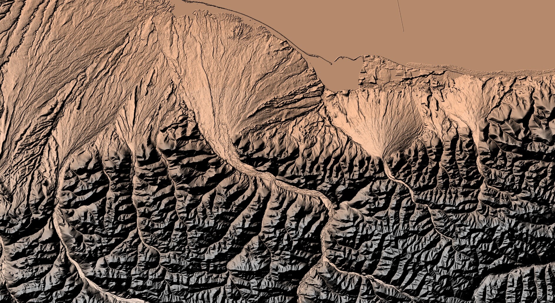
 Collaboration Advances Elevation Mapping – USGS EROS And NGTOC Work Together To Map A 1 Metre Digital Elevation Model For A Watershed
--
https://www.usgs.gov/centers/eros/news/collaboration-advances-elevation-mapping <-- shared technical article
--
https://doi.org/10.5066/P1CEPE2M <-- USGS data release, Lower Androscoggin Watershed Hydrologic Unit 8 Seamless 1-m DEM Pilot, 2013 to 2020
--
#GIS #spatial #mapping #remotesensing #LiDAR #water #hydrology #3dep #3dhp #3dtnm #NGTOC #spatialanalysis #elevation #DEM #EROS #seamlessonemeter #Androscoggin #ME #maine #research #integration #watershed #opendata
@USGS | @USGS_EROS

 for the Lower Androscoggin watershed in Maine, produced by scientists at NGTOC and EROS. Elevations run from low elevation in light blue on up to tan, green, yellow, red and finally gray/white. The lowest point in the watershed is -.109777 meters, and the highest is 1,916.04 meters.")


 of Tennessee area")


 near Fawn Creek (A) and Panther Creek (B). Fault scarps are visible as darker lineaments in the hillshade and are marked by the black arrows. Red rectangles on inset maps show location along the EGRCFS.")

 in northwest Yellowstone National Park (YNP). The location of the EGRCFS is shown as mapped in the U.S. Geological Survey Quaternary Fault and Fold Database, subdivided into the southern East Gallatin section (blue dashed line) and the northern Reese Creek section (black dashed line). Red rectangle on inset map shows location within Yellowstone National Park.")


 For this hurricane season, the [U.S. Geological Survey (USGS) Geospatial Information Response Team] GIRT has a newly designed, publicly available Event Support Map HUB site that offers access to applications, resources and information for hurricanes and other natural disasters…”


