
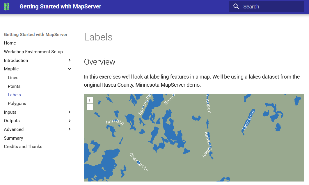
Join us for the "Getting Started with MapServer" workshop at @foss4geurope https://talks.osgeo.org/foss4g-europe-2025-workshops/talk/F3GHKV/
#osgeo #mapserver #foss4ge2025

Join us for the "Getting Started with MapServer" workshop at @foss4geurope https://talks.osgeo.org/foss4g-europe-2025-workshops/talk/F3GHKV/
#osgeo #mapserver #foss4ge2025
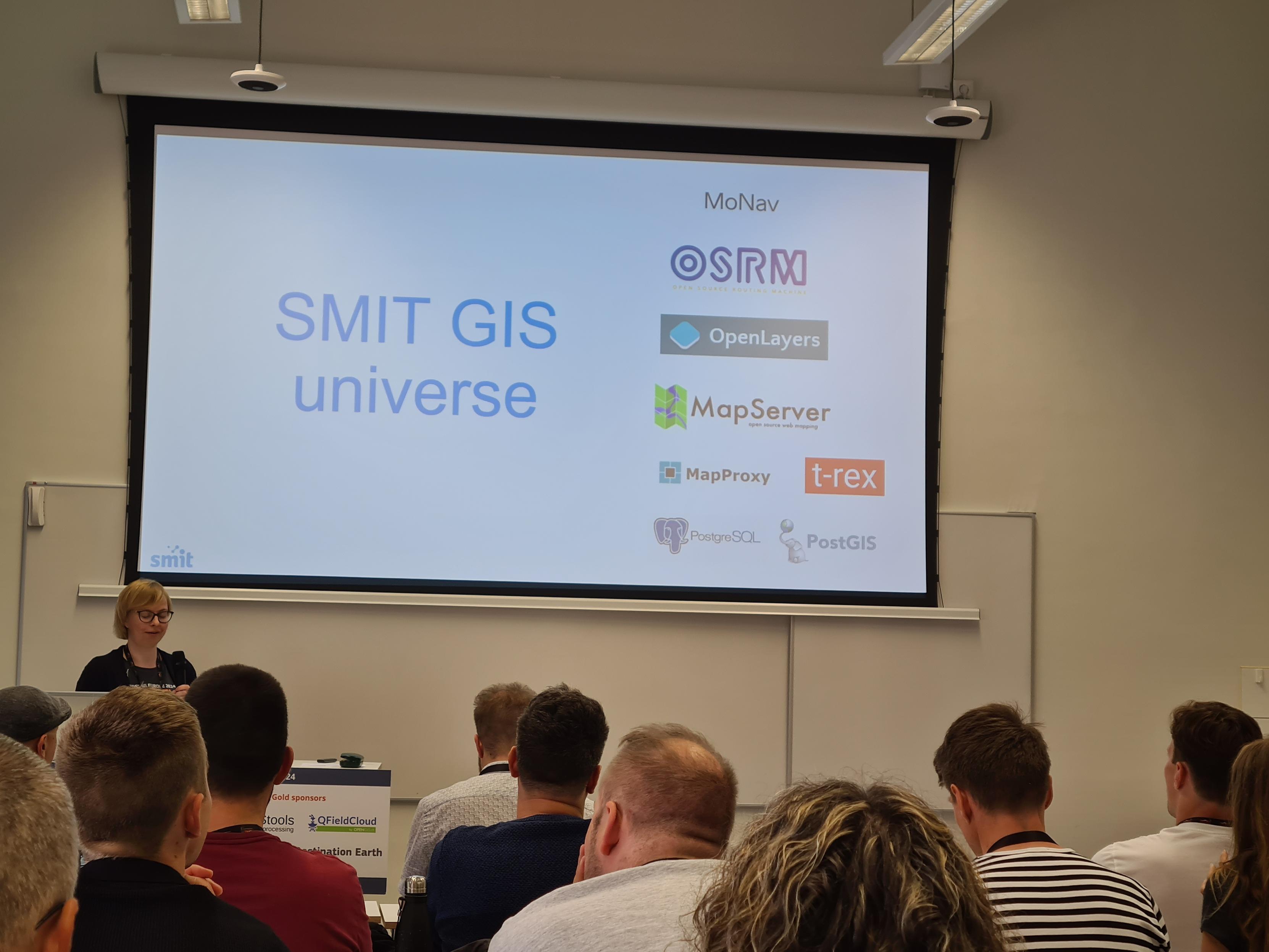
Great to see the talk from Katre Kasemägi from SMIT about the software stack used to provide services in Estonia for the internal security organisations. Services are setup with #MapServer, #OpenLayers, #PostGIS & also #MapProxy is in action. Phantastic! #FOSS4GE20224 is taking place in the right country!
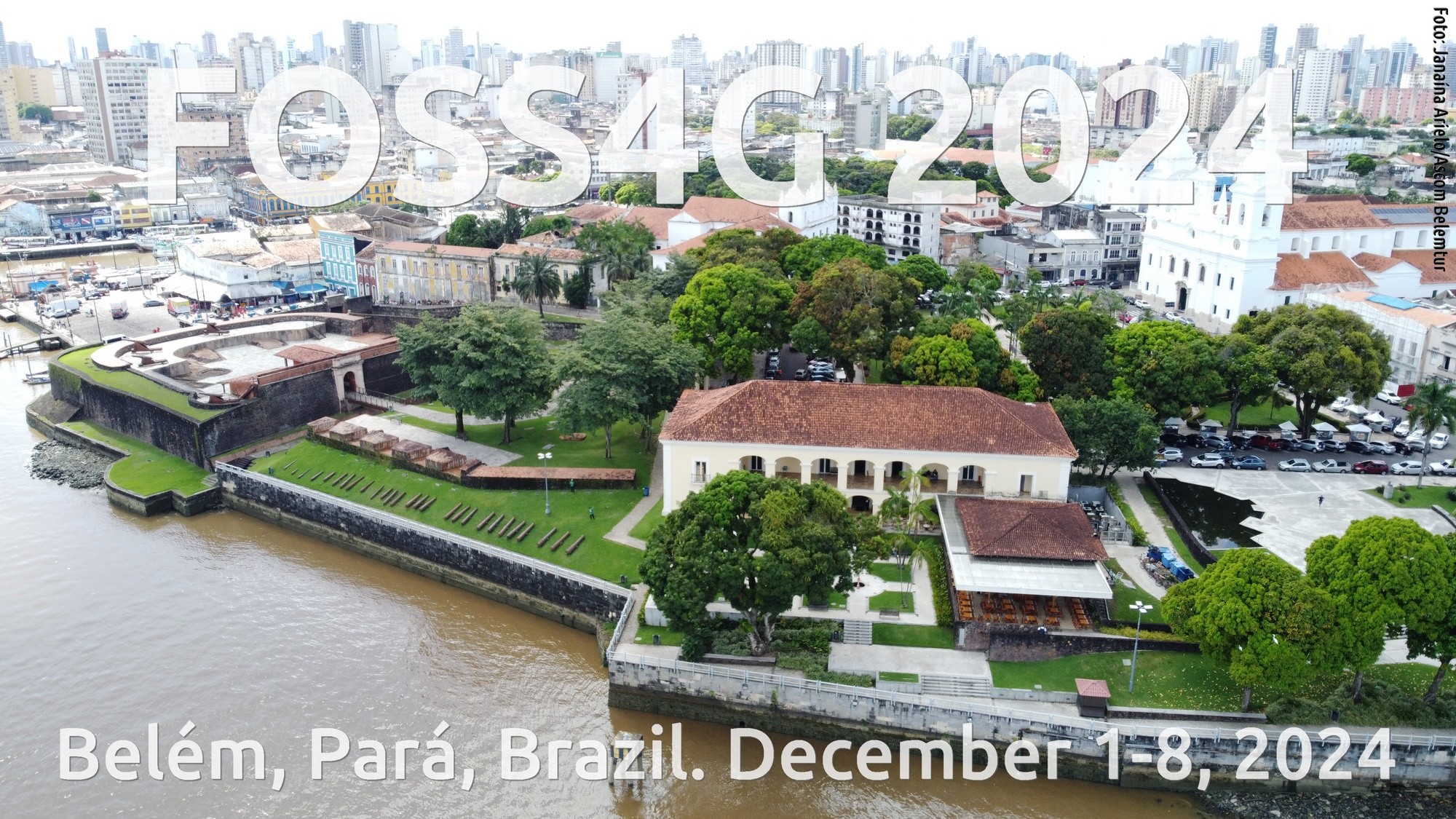
FOSS4G 2024
Belém, Pará, Brazil. December 01 - 08, 2024.
#foss4g #osgeo #qgis #geoserver #geonode #mapserver #grassgis #sagagis #postgis #rspatial
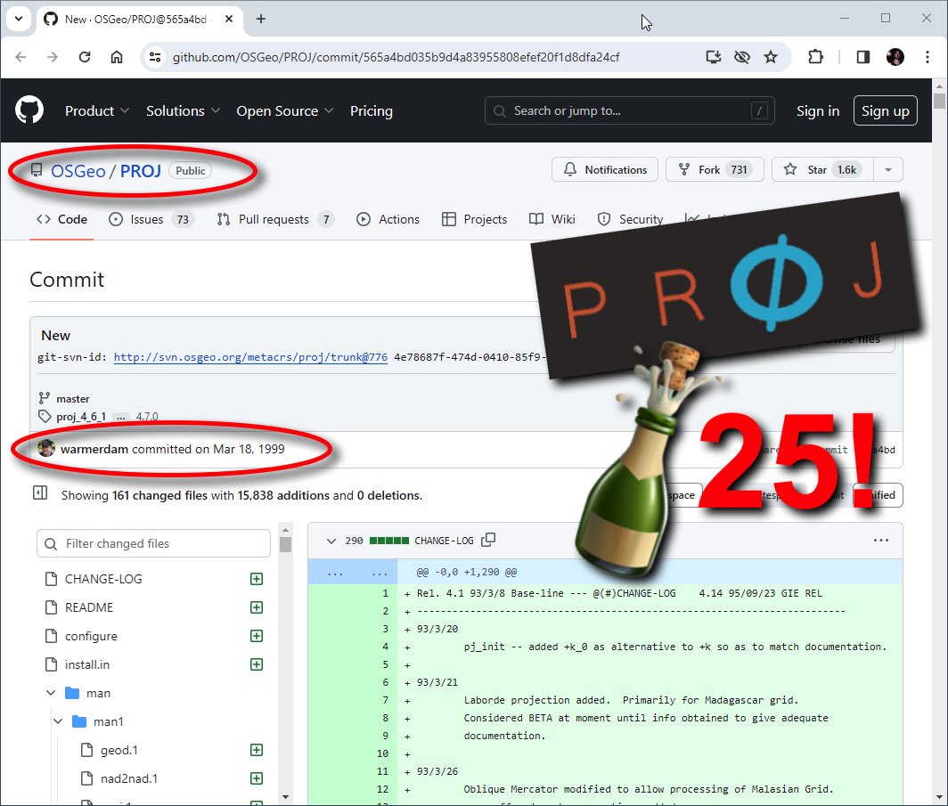
1999-2024: Happy Birthday PROJ! https://geoobserver.wordpress.com/2024/03/19/1999-2024-happy-birthday-proj/ #proj #gistribe #gischat #fossgis #foss4g #OSGeo #spatial #geospatial #opensource #GDAL #GRASS #MapServer #PostGIS #QGIS #R #FME #ESRI #gis #geo #geoObserver pls RT via @mapserving
Hey #gischat, I have one GIS file and want to serve it via #WFS (1/2). Is there any super cool, super easy, super sexy, modern tool for this?
#mapserver, #QGIS server etc are all way too much trouble for this. I prefer to run a single binary with a simple config.
OGC API would be an option too but currently I would prefer WFS 2.
UNVT Portable - Portable MapServers For Disaster Response
--
https://github.com/unvt/portable
--
" ‘UNVT Portable’ is a package for RaspberryPi that functions as a map hosting server and can be freely accessed from a web browser within a local network.
It is mainly intended to function in an offline environment during times of severe disaster, and is expected to play an active role... where disaster response headquarters are set up to assess the situation and respond to disasters by combining aerial drone images taken after a disaster occurs with OpenStreetMap and various open data tile data sets prepared in advance…”
#GIS #spatial #mapping #gischat #portable #mapserver #raspberrypi #raspberry #hosting #server #webbrowser #localnetwork #onsite #disasterresponse #hardware #solution #opensource #openformat #responsecenter #disasterresponsecenter #headquarters #readyresponse #mobile #mobileoffice #emergencyresponse #emergencymanagement #emergencypreparedness #risk #hazard #onlinemapping


Springer Makes Open Source Chapter Of Upcoming Handbook Of Geographic Information Freely Accessible In April
-
https://link.springer.com/chapter/10.1007/978-3-030-53125-6_30 <-- shared & free journal issue
-
[a good overview of open source GIS software stacks - with an OUTSTANDING and comprehensive reference list/links at the end!]
“... As a service to the readers, the reference section of this chapter includes scientific video recordings which provide additional content regarding software capabilities, historical notes and background information: #Actinia, #GeoBlackLight, #GeoPaparazzi, #GeoPython, #GeoServer, #GeoTools, #GMT, #GRASSGIS, #gvSIG, #JTS, #Leaflet, #MapServer, #NASAWorldWind, #OSGeoLive. #PostGIS, #PROJ, #QGIS, #rasdaman. In addition, scientific videos about the #OSGeo Foundation and the annual #SolKatzAwards or #GeospatialFreeandOpenSourceSoftware are included…”
#GIS #spatial #mapping #free #opensource #software #FOSS #opensourcesoftware #algorithms #geospatialtechnology #postgresql #postgres #softwarestacks


No plans to implement this on https://oldinsurancemaps.net anytime soon (not really helpful for large-scale insurance maps), but perhaps eventually... Also shout out to #mapserver, the hero of the live preview here.
Der #minetest #mapserver für unseren Bildungsserver läuft wieder und die Map wird gerade wieder aufgefüllt. Schaut mal vorbei: http://136.243.82.83:8080/#!/map/0/12/0/0


 Greg Cocks
